Andover held its second meeting for its Shawsheen River Master Plan last week, updating stakeholders on the progress of the effort.
Members and town officials outlined work that had been completed so far in the first, data-collection phase of the process. This fall, the group will hold two workshops to “create a shared vision” for the river as it runs through Andover based on feedback, which ranged from increasing public access and recreational activities to flood mitigation.
The presentation from the Aug. 10 meeting is available on the town’s Website. Upcoming master planning events include a visit to Walden Pond and Acton Arboretum on Aug. 27, a community workshop at 6:30 on Sept. 22 at Memorial Hall Library and an interactive workshop with stakeholders on Nov. 5. See the Shawsheen River Master Plan Website or contact Conservation Director Robert Douglas (conservation@andoverma.gov or 978-623-8630) for more information.
The 26.7-mile river starts in Bedford on the Hanscom Air Field and runs northward through Billerica, Wilmington, Tewksbury, Andover, and Lawrence, where it joins the Merrimack River. Given the number of towns in the 78-square-mile watershed, recent initiatives addressing the river have been more regional in focus. But some efforts, like proposals to increase access, will have to stem from local efforts like the master plan now underway.
Andover’s “industrial heritage is closely tied to the Shawsheen River, as is the community’s ability to adapt to future climate impacts,” according to the Shawsheen River Master Plan Website. “Flooding along the Shawsheen River has caused significant damage in Andover at least four times since 2007, but the river also provides significant recreational, social, and aesthetic benefits to the Town.”
Remove The Ballardvale Dam?
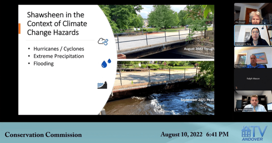
Andover Sustainability Director Joyce Losick-Yang said a key goal of the master plan is to mitigate risks from climate change. She noted that less than a year ago the water level nearly crested bridges along the river in Andover, yet last week, following a record-breaking heat wave, the riverbed could be seen from the bank (photo, above).
Losick-Yang said the town has submitted an application for state funding for the next phase, which will assess the impact and costs of flood mitigation strategies. She said the extreme swings between drought and flooding is a “trend that is likely to continue.”
One possible solution: remove the Ballardvale Dam, which was built in the 19th century and is less than three miles away from what Losick-Yang called “the flooding hot zone.” That option will be studied in detail during the next phase. In addition to mitigating flood risk, dam removal would help aquatic life: the removal of two dams downriver in 2016 and 2017 allowed alewife and blueback herring to spawn upstream to the Ballardvale Dam for the first time in over 200 years.
Increasing Recreation On The River
One key improvement identified by stakeholders on phase one was increasing recreational opportunities, especially for disabled people.
Jim McSweeny, Andover’s deputy director of facilities, said he had been working with an outside firm, Parcorp, to study Pomps Pond, Shawsheen Pines and Nason’s Landing off of River Street as possible locations to build accessible launches for kayaking. Parcorp identified a list of pros and cons for each site and s now working on cost estimates and designs.

